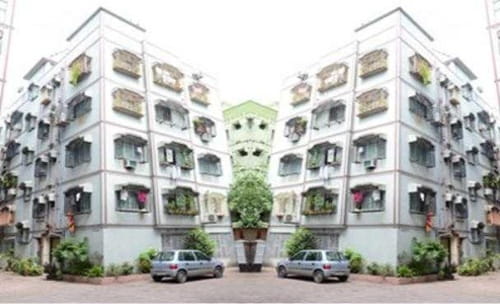
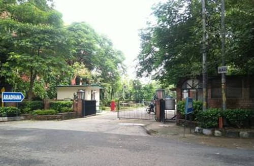
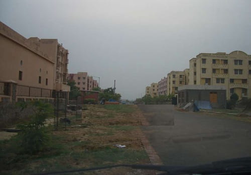
West Delhi’s residential map west of Rohtak Road carries a particular working-class density — Nangloi, Sultanpuri, Kirari, Mangolpuri — each with its own colony boundaries, local markets, and commuter population that uses the Green Line metro and the area’s DTC bus network to reach jobs across the city. Friends Enclave sits within this geography, a residential locality on Nangloi-Sultanpuri Road, Sultanpuri, West Delhi 110086. Its internal geography is organised in sectors — Sector 1 and Sector 2 are the confirmed sub-addresses, with Sector 2 specifically referenced in locality databases as Nangloi Sultanpuri Road, Sector 2, Friends Enclave, Sultanpuri. The locality falls under the Sultanpuri South ward, Sultanpur Majra assembly constituency, represented by MLA Mukesh Kumar Ahlawat, under the North West Delhi Lok Sabha constituency with MP Hans Raj Hans.
Friends Enclave’s PIN code is 110086, under the Sultanpuri F Block post office. Nearby localities include Block X, JJ Colony No. 3, Camp No. 1, Raj Park, Punjabi Basti, Ratan Vihar, Aman Vihar, and the broader Nangloi belt. Rathi Hospital is the most specifically cited healthcare landmark, confirmed by Mappls at the Friends Enclave, Sultanpuri Road, Nangloi address. Indira Jheel — a lake within Sultanpuri — is approximately 1 kilometre from the locality, one of West Delhi’s underrated green spaces and a neighbourhood walking destination for residents.
| Quick Overview | Details |
| Location | Nangloi-Sultanpuri Road, Sultanpuri, West Delhi |
| PIN Code | 110086 |
| Post Office | Sultanpuri F Block |
| Ward / Constituency | Sultanpuri South / Sultanpur Majra Assembly |
| MP | Hans Raj Hans (North West Delhi Lok Sabha) |
| Nearest Metro | Nangloi Metro Station (Green Line, ~2–3 km) |
| Nearest Railway | Nangloi Railway Station; Mangolpuri Railway Station |
| Key Roads | Nangloi-Sultanpuri Road, Rohtak Road (NH-9), NH-248BB, NH-44 |
| Key Hospitals | Rathi Hospital; MCW Sultanpuri F Block; DGD Sultanpuri |
| Sultanpuri Avg. Rate | ₹8,192 per sq. ft. (2026) |
The Locality: Dense, Community-Rooted, and Practically Self-Sufficient
Friends Enclave’s residential character maps onto the broader Sultanpuri-Nangloi belt — predominantly independent houses and builder floors in the mid-income segment, a locally oriented community, and the kind of neighbourhood commerce that makes daily provisioning walkable rather than a car trip. The nearby localities confirm the residential fabric: Raj Park immediately adjacent, Ratan Vihar to the south, JJ Colony No. 3 on the northern side, and the Sultanpuri block system extending westward. Sultanpuri is one of Delhi’s denser localities, and Friends Enclave’s position along Nangloi-Sultanpuri Road places it on the arterial spine connecting these two major western belts.
The onefivenine database confirms two government health centres within immediate reach — MCW Sultanpuri F Block (Mother and Child Welfare Centre in the F Block Janta Quarter), DGD Sultanpuri (Delhi Government Dispensary in B Block), and MCW Jawalapuri (in A Block, Jawala Puri) — all within the Friends Enclave locality map’s coverage. This density of government health infrastructure is a practical daily-life positive for a working-class residential belt where ESI-covered employees and families rely on government dispensaries for routine healthcare. Rathi Hospital on Sultanpuri Road is the nearest private hospital, confirmed by its Mappls address at Friends Enclave, Sultanpuri Road, Nangloi, Delhi 110086.
The Sultanpuri bus terminal and the multiple DTC bus stops along Nangloi-Sultanpuri Road handle the locality’s primary public transport needs. Bus routes confirmed from the locality include: 567 (Lajpat Nagar–Nangloi), 569 (Safdarjung Terminal–Sultanpur), 569 EXT (Safdarjung Terminal–Indra Enclave), 846 (Tilak Nagar–Sultanpur), and 908 (Karampura Terminal–Sultanpur). The reach of these routes is significant — Lajpat Nagar, Safdarjung, Tilak Nagar, and Karampura are all reachable by direct bus from the Friends Enclave belt, covering South Delhi, Central Delhi, and West Delhi employment and commercial destinations.
Nangloi Metro and the Green Line Corridor
Nangloi Metro Station on the Green Line is approximately 2 to 3 kilometres from Friends Enclave along Rohtak Road — a 10 to 15-minute auto or e-rickshaw ride from the Sultanpuri-Nangloi Road junction. The Green Line (Brigadier Hoshiar Singh–Inderlok/Kirti Nagar, 24 stations, 28.79 km) gives Friends Enclave residents access toward Paschim Vihar East and West, Peeragarhi, and the Inderlok interchange with the Red Line, or westward toward Mundka, Bahadurgarh City Park, and the Haryana extension at Brigadier Hoshiar Singh station. Surajmal Stadium Metro Station and Udyog Nagar Metro Station are also referenced for the broader Sultanpuri belt in 99acres’ connectivity data.
Nangloi Railway Station is one of the closest rail access points — a Delhi Ring Railway station that handles suburban services. Mangolpuri Railway Station is a second option for suburban and inter-city rail access from the western belt. NH-9 (Rohtak Road) and NH-248BB are both reachable from Friends Enclave, with NH-44 also cited as accessible — giving road-based inter-city connectivity toward Haryana (Rohtak, Bahadurgarh, Hisar) and beyond for residents who travel frequently by road or bus. Peeragarhi is reachable from the Sultanpuri belt in approximately 15 minutes; IGI Airport is approximately 50 minutes via Outer Ring Road.
A new bus depot inaugurated in Nangloi by the Delhi government — one of four new depots opened as part of the city’s electric bus fleet expansion, targeting approximately 8,000 electric buses citywide — reflects active public transport infrastructure investment in this corridor that will directly benefit Friends Enclave’s daily commuters.
Bharat Darshan Park and Bhuli Bhatiyari Ka Mahal
Two specific landmarks in the broader Nangloi belt give the area a cultural and recreational character that residents rarely mention explicitly but that distinguishes it from purely functional west Delhi addresses. Bharat Darshan Park, within the Nangloi belt, contains miniature replicas of India’s iconic monuments — a genuinely unusual public park concept built specifically for families who may not be able to travel to landmark sites. Bhuli Bhatiyari Ka Mahal, a 14th-century Tughlaq-era hunting lodge within the Delhi Ridge forest adjacent to the Nangloi belt, is one of the few medieval ruins in West Delhi — an archaeological monument surrounded by forest that sits in complete contrast to the dense urban fabric around it.
Indira Jheel in Sultanpuri — approximately 1 kilometre from Friends Enclave — is the locality’s nearest water body and green space, used for morning walks and community gatherings. This combination of a medieval ruin, a monument park, and a urban lake within the locality’s extended neighbourhood gives Friends Enclave’s residents recreational options beyond what the colony’s own density would suggest.
Schools and Healthcare
RD Public Senior Secondary School and Geeta Senior Secondary School are cited for the Sultanpuri belt. HS Public School and DS Memorial Public Senior Secondary School serve the broader Nangloi-Sultanpuri corridor. Maharaja Agrasen Institute of Technology (for technical higher education) is referenced for the Inder Enclave belt adjacent to the area. Sovereign Public School serves the locality. MCW Sultanpuri F Block and DGD Sultanpuri provide government-subsidised maternal, child, and primary healthcare within the locality’s immediate geography. Nirmal Hospital and Action Balaji are cited for Sultanpuri’s private healthcare. Rathi Hospital on Friends Enclave’s Sultanpuri Road address is the nearest named private facility.
FAQs
Q1. What is the PIN code of Friends Enclave, Nangloi, Delhi?
A: 110086, under the Sultanpuri F Block post office. Friends Enclave is on Nangloi-Sultanpuri Road, Sultanpuri, West Delhi. Its internal sectors include Sector 1 and Sector 2. The locality falls under the Sultanpur Majra assembly constituency.
Q2. Which metro station is nearest to Friends Enclave, Nangloi?
A: Nangloi Metro Station on the Green Line, approximately 2 to 3 kilometres away via Rohtak Road. Surajmal Stadium and Udyog Nagar Metro Stations are additional options for the broader Sultanpuri belt. The Green Line connects toward Inderlok (Red Line interchange), Paschim Vihar, and Bahadurgarh, Haryana.
Q3. Which railway stations serve Friends Enclave, Nangloi?
A: Nangloi Railway Station and Mangolpuri Railway Station — both Delhi Ring Railway suburban stations — are the nearest rail options. They provide suburban services and inter-city rail access for residents who commute or travel by train.
Q4. What are property rates near Friends Enclave in 2026?
A: Sultanpuri’s average rate is ₹8,192 per sq. ft. for independent houses and builder floors in 2026 per NoBroker data. Monthly rents in Nangloi run ₹12,800 to ₹30,000 for various configurations. The area is characterised as mid-income and affordable relative to other Delhi belts.
Q5. What are the primary government health facilities near Friends Enclave?
A: MCW Sultanpuri F Block (Mother and Child Welfare Centre) in the F Block Janta Quarter, DGD Sultanpuri (Delhi Government Dispensary) in B Block, and MCW Jawalapuri in A Block, Jawala Puri — all within the Friends Enclave locality map’s immediate coverage. Rathi Hospital is the nearest named private facility on Sultanpuri Road.